Bikepacking is a bit like hiking, a bit like backpacking, a bit like bicycle touring and a bit like mountain biking. In fact, you could say that it combines them all. Typically, a route suitable for bikepacking will be of such a distance that at least one overnight stop is required – this usually means that the route will be at least 200km, with the Bearbones event in Wales being this distance, the Capital Trail – centred on Edinburgh – being a little more, the Cairngorms Loop running to 300km and – the queen of them all – The Highland Trail 550 running to 860km, with an allowance of up to 8 days for an official completion.
The idea of a bikepacking route is that it should be “self-supported” – that is the rider should carry all that is required for warmth, safety, adverse weather, sleep, shelter, nutrition, illumination etc. about his bike or person. Hence the advent of bikepacking bags in recent years that permit bags to be attached directly to the bike, so bypassing the inevitable rattles and shakes that would result from using any system based on pannier racks over rough terrain.

The terrain for a bikepacking route will tend to be diverse, occasionally challenging and frequently requiring stretches where the bike has to be pushed in order to progress – called Hike A Bike (or HAB). A typical route is likely to be quite different to a recreational MTB trail centre and, in the more extreme cases, like the Fisherfield crossing on the Highland Trail or the Lairig an Laoigh traverse on the Cairgorms Loop, can be comparable to “off-piste” skiing. A degree of self-sufficieny in looking after bike, body and soul is definitely a prerequisite, especially as the more extreme routes are outside of mobile network for prolonged stretches.
What then is the difference the between a long bike ride in the open countryside, and a bikepacking route? Ultimately, it comes down to participation: a bikepacking route is created with the intention of more than just the route’s originator riding over the course; at the same time, the intention is not to create a sudden influx of people riding into previously remote, little-known and/or unspoilt terrain. Currently, even the best known routes have little more than a hundred people a year completing them.
A bikepacking route can exist in its own right as a route that individuals choose to ride at their own pace. For some popular routes, a record is kept of verified fastest attempts at the route; additionally, the routes mentioned previously typically have a massed start once a year, where riders start off together, but then ride individually to record their own time, selecting their pace, sleeping opportunities and visits to food sources to suit their own abilities.
In short, a bikepacking route can exist perfectly well without a massed start event being associated with it, but, by the same token, the more inspiring routes are characterised by a coordinated start at some point in the course of each year.
Having participated in, and got to know and enjoy other riders’ bikepacking routes, and – perhaps most importantly – having gained a good understanding of the ethos of self-supported mountain biking, it was natural that I would eventually look to my local terrain, centred around the vast expanse of Kielder forest, and start formulating some kind of route in my head. In fact the first draft of the route has been in existence for a year, but it was on a weekend of reasonable autumn weather in late October 2017 that it became a little closer to becoming a reality.
My companion from many previous bikepacking trips, Stuart Cowperthwaite, was the natural choice and when it quickly emerged we both had the same weekend free it wasn’t long before we were driving to the route’s start point: the tiny village of Stonehaugh on the south east edge of Kielder forest. We eventually set off riding at 2100 on Saturday night with our lights on. After just 5kms, Stuart had stopped by his bike and was tending to what appeared to be a broken freehub body – what had been an unpleasant noise previously had now become a mechanism that would not disengage during free-wheeling. We pushed on, with him riding a 10 speed fixie and then, just as quickly as the problem arrived, it disappeared, leaving us both with the ability to freewheel again.
There was light rain in the air, so we were wearing waterproof jackets, however the elevated pace and undulating profile meant that we were soon quite warm. We moved swiftly through the 20km forest tracks to Falstone, where I quickly popped into the pub to fill up my bottle with water and Stuart oiled the freehub. The 200km route does not go to the new bothy of Flittingford, but it passes very close and I loaded up a separate gpx file to direct us to the night’s destination. I had never been there before, but I was pleased to navigate to within 30 metres and then to finally find the place by turning around in the dark and seeing it before us.
A new bothy visit is always a special occasion and we were both very impressed with the work that the MBA had done on bringing this building back to life. There was no-one else in residence when we arrived at 2245, so we quickly settled to getting our sleeping kit out; the late start meant that we had both had our evening meal so we just had a small can of ale and a bit of banter before sleeping through until 0700. We were up and riding before 0830, not before admiring the bothy, both inside and out.


The route took us North, through the forestry to the where the forest tracks join the A68 at Cottonshopburnfoot. From here we proceeded just half a kilometre until the right turn onto the Otterburn Ranges via Cottonshope farm. I had already checked with the Otterburn Ranges website that there was no military firing taking place this weekend and it was for this principal reason that we had chosen to do the route. We had not got very far up this remote road when we were stopped by an official from a motorsport event, informing us that we couldn’t proceed any further as the roads in the Ranges were being used by a rally. I pointed out that the red flags were not flying and we had specifically checked that we could access the Ranges and has planned our weekend around it. No matter, we couldn’t go further.
We went back down the road and it soon dawned on us both that we would have to do this Pennine Way loop to Alwinton in reverse. The main reason I had originally planned to go through the Ranges to Alwinton and then over Windy Gyle and the Pennine Way to Spithope was because this is how I had first rode this section earlier in the year and, notwithstanding the considerable climb from Trows to Windy Gyle, I saw no reason to change it.
We had not got very far past the earliest parts of the Pennine Way at Chew Green before my grumbling about the bumptious official began to turn around on itself: his turning us around was suddenly looking like a blessing in disguise as we realised that a strong wind was blowing at our back as we negotiated this exposed, boggy and mainly uphill terrrain. Even with a favourable wind and moving at a decent pace, progress was slow and the 19km from the A68 turn for Spithope and the summit of Windy Gyle took us 2 hours 36 minutes. The remote terrain can offer stunning views into Scotland – weather permitting! After three miles of the eight signposted from Chew Green to Windy Gyle, the spartan shelter at Lamb Hill is reached – a temporary respite or a safe haven in extreme conditions.


A peculiar characteristic of the track is that, while it is predominantly peaty and boggy, there are sections of slabs that greatly improve the possibility of riding, although these can be quite slippery at times, so are not entirely a panacea to forward motion.

The final hike up to Windy Gyle is not too prolonged and, once at the summit, only a few seconds are required to understand how the place obtained its name – if the actual meteorological conditions aren’t sufficient to convince you, a quick glance to the enormous stone summit shelter should.


From Windy Gyle, the route descends over 300m, mainly on a fast, grassy track to the small farm at Trows. Immediately you arrive at the foot of the descent, your cross the slippery ford and start heading back up the red track that is on your left side as you are still descending. This steady climb tops out with a sharp drop to a wooden bridge and then a prolonged, steep grassy ramp up to Clennel Street. From here there is a fairly rapid and sustained drop to Alwinton. By this point we had been riding – and occasionally pushing through boggy sections – at a fairly sustained pace for around four hours since starting off, so we were both ready for some decent nourishment at the pub. I was even going so far as to start salivating about the prospect of obtaining a Sunday lunch. As we passed the small village green there were many cars parked there, suggesting that quite a few Sunday drivers had headed out to Alwinton that Sunday with the same idea. In fact, as we drew up outside the pub we were faced with the dismal notice: No food being served this week!
We entered and sure enough the pub was under minimum staff for the week as the owners were away on holiday in warmer climes. Incredibly, the village pub in Harbottle, just 2kms down the road was open, but not serving food either! This was a bit of a problem, but there was little we could do, other than buy a bag of crisps, a can of coke and a double portion of Mars bars each. Fortunately, Stu had packed a plentiful supply of wraps featuring a whole variety of combinations based around peanut butter, including spinach, cheese and other things that I stopped listening to his description of!

We ate these outside after pondering just exactly what we were going to do to get back on route to Kielder: as the Ranges had been blocked to us at its south western entry, we were also expecting it to be blocked to us at its eastern entrance, just past the village of Harbottle at Holystone Common. However, we were hoping that by arriving around 3pm, the rally might be winding down or even finished.
In another example of his impeccable preparedness, Stu had OS mapping on his large screen smartphone and we were able to work out that we could entry the Ranges as planned at Harbottle, follow the road east only as far as Cocklaw Green and then drop south from there to Bennettsfield on the A68, proceeding for a further 10km or so on the main road through Horsely and Rochester back to junction of the Forest Drive at Cottonshopeburnfoot, where we had emerged some hours earlier. This was a deviation from the planned route, meaning that we would miss the Bushman’s Crag and Cottonshope Head stretch of the Ranges, plus we would be obliged to ride on the busy main road to Scotland. We had to hope that we could reason/argue our way this far along the Ranges road, because the only alternative was a mammoth road stretch from Harbottle to east of Billsmoor, then through Elsdon, Otterburn and finally to Byrness on the A68.
We made our way through the forest tracks of Harbottle Woods and caught a lovely rainbow, just at the point where we emerged on the road and started battling into a strong headwind.


We passed a couple of rally marshals, who were much more relaxed that the one we had met earlier in the morning. Once we told them our planned exit route south at Cocklaw Green and that we anticipated being off the Ranges and at the A68 in less than half an hour, they were fine in letting as proceed as there was no driving planned in this area in the near future.
The A68 was a headwind battle, just as the lumpy track west across the Ranges had been, but slowly we made our way towards the entrance to the Forest Drive track to Kielder Village on our left. This is signposted as being 12 miles and is characterised by a steady drag for about a third of this distance up to a first summit at Blakehope Nick (450m), then a second summit around Ewe Hill before a long descent into Kielder Village. We covered this stretch into an unfavourable wind in just over an hour and arrived at The Anglers Arms in Kielder ready for some warm food and really hoping that we weren’t going to score a hat trick of non-catering pubs. The reality couldn’t have been more pleasant: after having been moving from 0830 until just after 1700, we were finally treated to some quality warm food. Were also able to stock up on Snickers for the following morning too as this was our last supply point before reaching Stonehaugh the next morning. At this point we had around 130kms of the original route completed and had about 70 more to do. After our meal, we still had to ride for an hour or so to Kershopehead bothy, which was close to the 50km to go point.


As we left the pub it still wasn’t dark, but we had prepared our lights ready to switch them on at some point in the near future. Through familiar trails, we skirted the reservoir for a few kilometres and then headed east towards Newcastleton Forest on the Cross Border Trail. Just as the light was fading and we switched on out light, we startled a badger waddling furiously down the track in front of us. This was in addition to the badger, fox and small deer that we had spotted the previous night on the way over to Falstone.
I had originally planned the route to effectively overshoot the bothy, by going about 4km further south-east to the bridge crossing of Kershope Burn, and then to return up the east side of the burn to the refuge; however, I have crossed this burn many times and we cut this 8km out by wading across near to the point marked as Kaim Brae on the map. We were soon at the bothy, arriving at the more civilised time of 1900, as oppose to something like four hours later the previous evening.


Once settled in the bothy, we made a vague attempt to light the stove with some twigs and wood we had found around, but even with a the stimulation of a splash of meths we didn’t manage to create anything very long-lasting. It was around 14°C inside and, although our feet were drenched from the recent water crossing, we weren’t too cold. As we had finally obtained and enjoyed a hearty meal in Kielder, we just had a Mug Shot pasta portion each mixed with some thin Polish cooked sausages. We then chatted for quite a while before falling asleep at 2200 after a long and challenging day. We had come a long way, what with temperamental freehubs, impromptu route deviations and near starvation in the remote countryside (!), but it was good to know that we had less than 3 hours riding to do in the morning to complete our route back to Stonehaugh.
I was awakened in the dark by the sound of rustling and the flickering of a headtorch – it was the commotion caused by my companion pronouncing himself wide awake at 0600 and getting on with packing his sleeping kit away. I protested that this was perhaps a trifle early, but deep down I knew he was right. He was quoting the weather forecast that he had caught at the pub in Kielder, which was predicting rain in the morning. As it wasn’t raining yet, I had to concede that there was indeed some sense in his proposal to get up and start moving as soon as possible. We were actually quite slow getting up and having breakfast, but we were still out the door with our lights on and moving at 0730.
My route from Kershopehead appeared rather contorted, but in actual fact was the most direct way in a southerly direction to High Onset farm, using the fast forest tracks that pass via Blakelyne House. We were immediately making a very brisk pace and I intuitively knew that a) Stu was feeling good and b) he had picked some improbably fast average speed on his Garmin and would now be hellbent on maintaining it all the way to Stonehaugh. The small road link to Crossgreens passed quickly and then we were on the stretched out climb to Bullcleaugh Gate – a stretch of track that we had last ridden together in April, going in the opposite direction on The Dirty Reiver event.
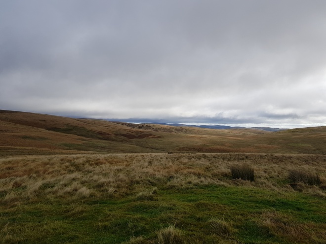
My route avoids the water crossing at Paddaburn, used by the Reiver, and instead favours the more southerly parallel route via Potsloan, that I had ridden for years before the gravel event came into existence. Through Whitehill, Felecia Crags, Green and the last hill to Harelaw, Stu and I traded high speed blows, with the author perhaps feeling the more ragged of the duo as the picture below attests:

Finally, finally we called a truce and headed back on the last couple of miles on the road to Stonehaugh at a more civilised pace. Once we got back, we found that despite missing a few kilometres on the eastern section of the Ranges and also not doing the 8km extra to Kershopehead, we had still managed to come in with a total of 201km since leaving late on Saturday evening.

So back to my original preamble: is the route a bikepacking route? Well, it certainly has the potential for bike, bivvy and bothy, but does it have enough potential to tempt somebody else to upload the gpx route and have a go at it? I hope so, as long as that person knows how to take care of themselves in remote countryside.
The obvious drawback of the route is the reliance on military clearance for the only major road section, which crosses the deserted roads of the Otterburn Ranges. However, as we discovered, it is not simply a question of ascertaining that the ranges aren’t being used for military purposes, but what recreational activities may also be taking place, e.g. a car rally.
The link for the final version of the route is below. This includes the section to Windy Gyle approaching from Spithope because, after having ridden it previously from Alwinton, I now feel the western approach that Stu and I completed is the better option.
Information:
https://www.gov.uk/government/publications/otterburn-firing-times
Official advice for Otterburn Ranges:
- When military exercises are happening, red flags around the boundaries indicate restricted access.
- Do not pick up, kick or remove any object.
- Do not stray off the public rights of way or tarmac roads.
- There is no guarantee that roads and tracks will be salted or cleared of snow in bad weather.
If you are in any doubt about where you can go, please contact the Range Liaison Officer by phoning 0191 239 4201/0191 239 4227. [Very helpful and the Captain I spoke to was a gravel bike rider himself.]
GPX route file:
https://www.gpsies.com/map.do?fileId=ojhbsctxcunnwpuj

And all on bridleway?
LikeLike
Yes the forest tracks are double width, you could drive a 4×4 on them.
LikeLike
Philip, Seems like you were lucky with the weather.
I had a search to see if there’s any central resource for rally events and came across this page – http://www.itsmymotorsport.co.uk/by-month.htm
Looks like it’s mostly decent tracks apart from the section over Windy Gyle
LikeLike
Thanks Bob. Been in touch with the Ranges captain this morning and he was sympathetic agreeing the MOD website could have been clearer and that the rally official could have handled it differently.
LikeLike
Great write up Phil, really enjoyed it. Looking forward to ridnignthat sometime. I ride a fair bit in Kielder too, but more on the well known routes, and those that Ive covered on the DR. Must try to be a bit more imaginative in my route planning!
LikeLike
Thanks Richard! Yep if you’re looking to go a little off piste then I hope you’ll enjoy some/all this route. Cheers Philip
LikeLike